Arboretum
The mission of the Kenton County Cooperative Extension Arboretum is to provide a place of recreation, education, and beauty.
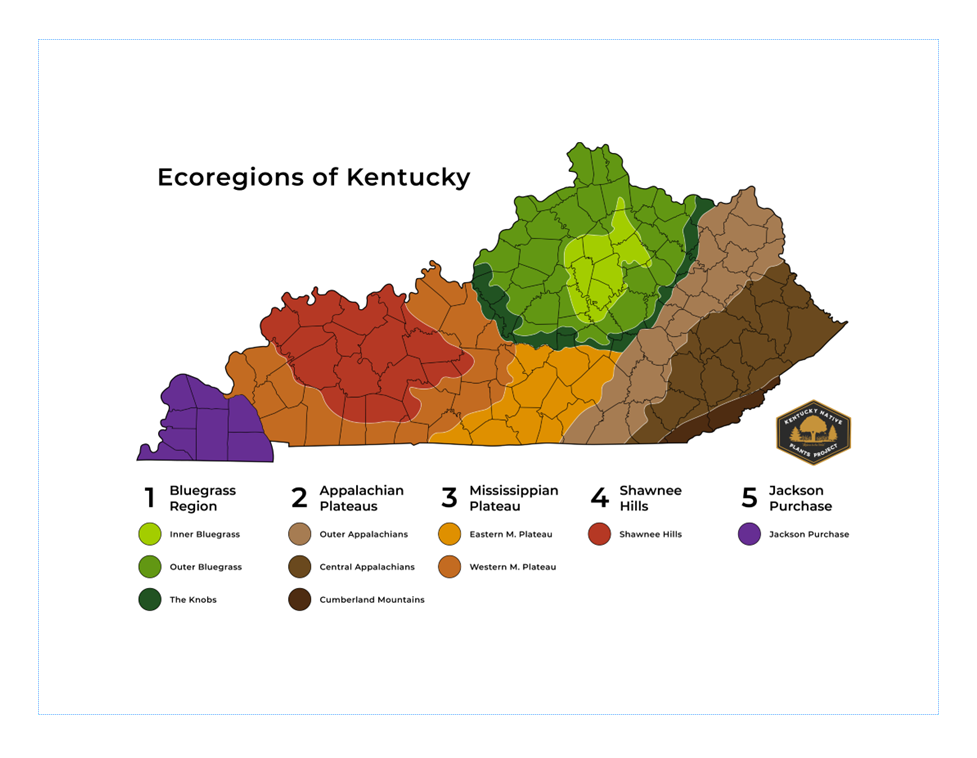
Welcome! Here you will find over 100 woody plant species at our 3.5-acre site. To our best estimate, we have over 90% of the woody plant species native to the Outer Bluegrass ecoregion which Kenton County falls within.
We are incredibly grateful for the funding that was provided by The R.C. Durr Foundation, the Northern Kentucky Urban & Community Forestry Council, and for the dedicated efforts of our volunteers who work tirelessly to support our mission. Thank you!
“The Bluegrass Region is in north-central Kentucky and contains cities like Louisville, Lexington, and Covington. Its name comes from a European grass species introduced to Kentucky. The area is known for its fertile soils, enriched with minerals from the abundance of limestone found in the area. This limestone also results in a basic soil pH in the region, making it ideal for specific plants. Historically, the Bluegrass was an open-savanna ecosystem with large trees scattered over an understory of grassland. However, after the pioneers arrived, almost every acre in the region was converted to farmland, erasing the natural landscape. The Bluegrass region contains three sub-regions: the Inner Bluegrass, the Outer Bluegrass, and The Knobs. The Outer Bluegrass surrounds the Inner Bluegrass and is the largest of the Bluegrass sub-regions. It is similar to the Inner Bluegrass but is less flat with deeper valleys. These features are due to a mixed shale and limestone bedrock, making it more erosion-prone than the Inner Bluegrass's thick limestone bedrock.” (Kentucky Native Plants Project)